Population Density by Canadian Province (2011)
Electricity infrastructure costs more per capita when the population is spread out across a large area. Here we see show the 2011 population density in each province and territory in Canada. The population density in all of Canada is 3.7 people per square kilometre.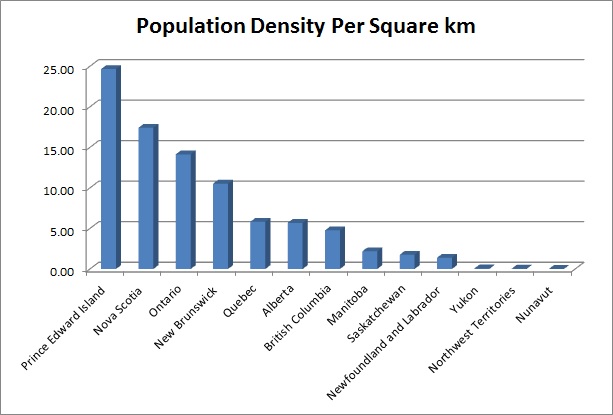 |
||||||||||||||||||||||||||||||||||||||||||||||||||||||||
|
||||||||||||||||||||||||||||||||||||||||||||||||||||||||
Here we show a graph which compares all of the provinces by population. Canada's total population in 2011 was 33,476,688. 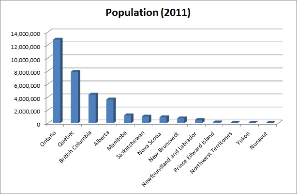 And here you can see all of the provinces arranged by area in square kilometres. Canada's total land area is 8,965,121 square kilometres (3,461,456 square miles). 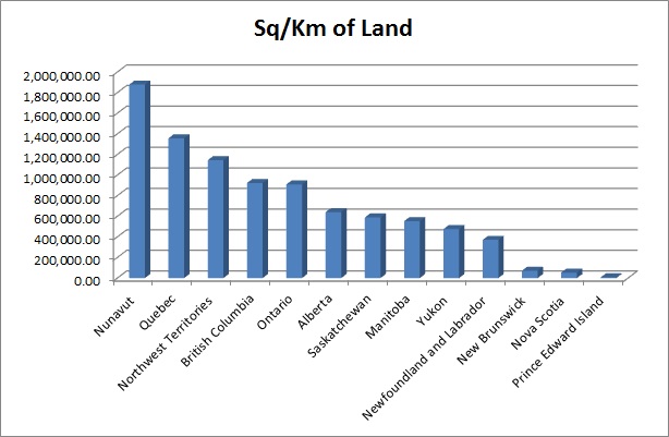 |